SuitAbility Tour
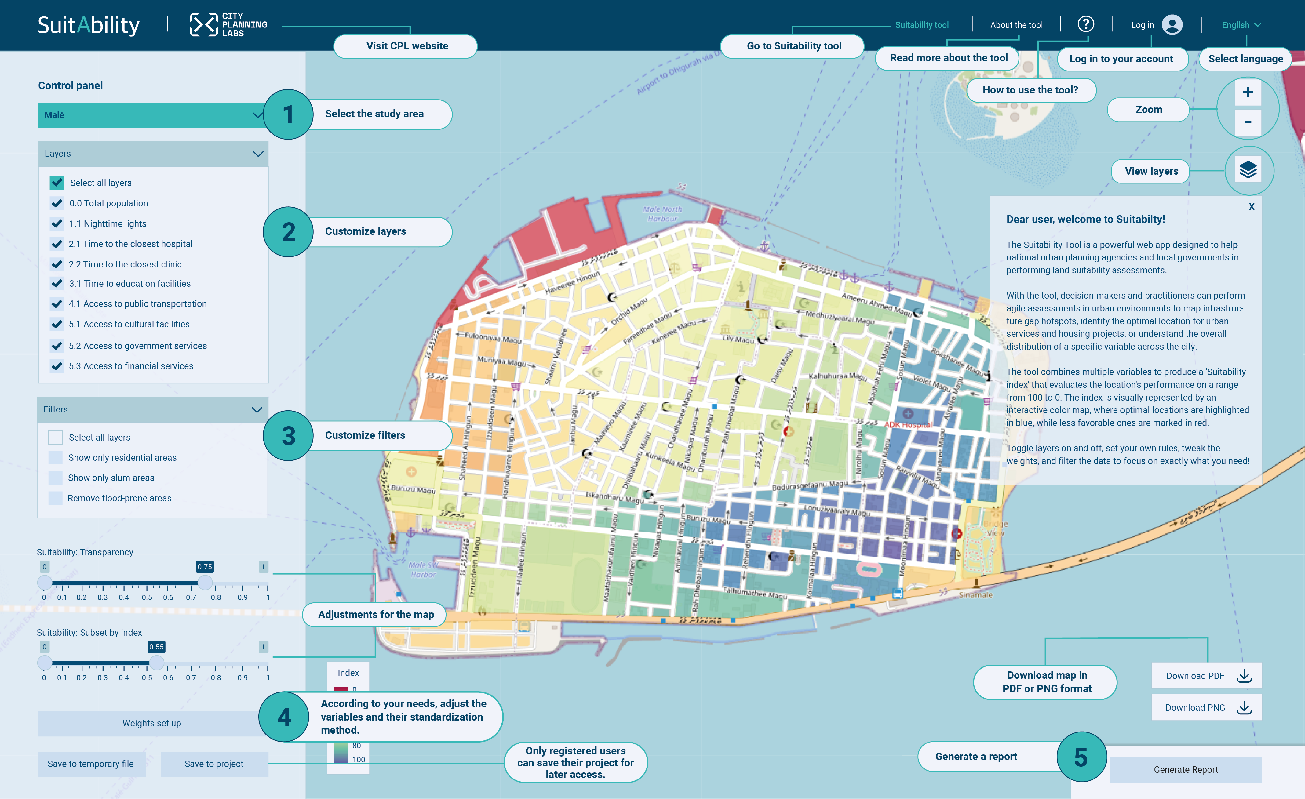
The Suitability Tool is a powerful web app designed to help national urban planning agencies and local governments in performing land suitability assessments.
With the tool, decision-makers and practitioners can perform agile assessments in urban environments to map infrastructure gap hotspots, identify the optimal location for urban services and housing projects, or understand the overall distribution of a specific variable across the city.
The tool combines multiple variables to produce a 'Suitability index' that evaluates the location's performance on a range from 100 to 0. The index is visually represented by an interactive color map, where optimal locations are highlighted in blue, while less favorable ones are marked in red.
Toggle layers on and off, set your own rules, tweak the weights, and filter the data to focus on exactly what you need!

About
The Suitability Tool (ST) is a web-based urban planning tool that identifies optimal locations for a specific activity within a city. By integrating spatial data, Suitability allows urban planning agencies and city governments to find strategic locations.
The Suitability tool has three main functions: data integration, spatial assessment, and consensus building. First, it compiles geo-located environmental, social, and urban information from local sources and international databases. It then processes the data using flexible and customizable methods to create a Suitability Index that evaluates the performance of different sites. Finally, it enables rapid spatial visualization of site recommendations to inform policy decisions and support evidence-based consensus among stakeholders.
For example, you can use Suitability to: